
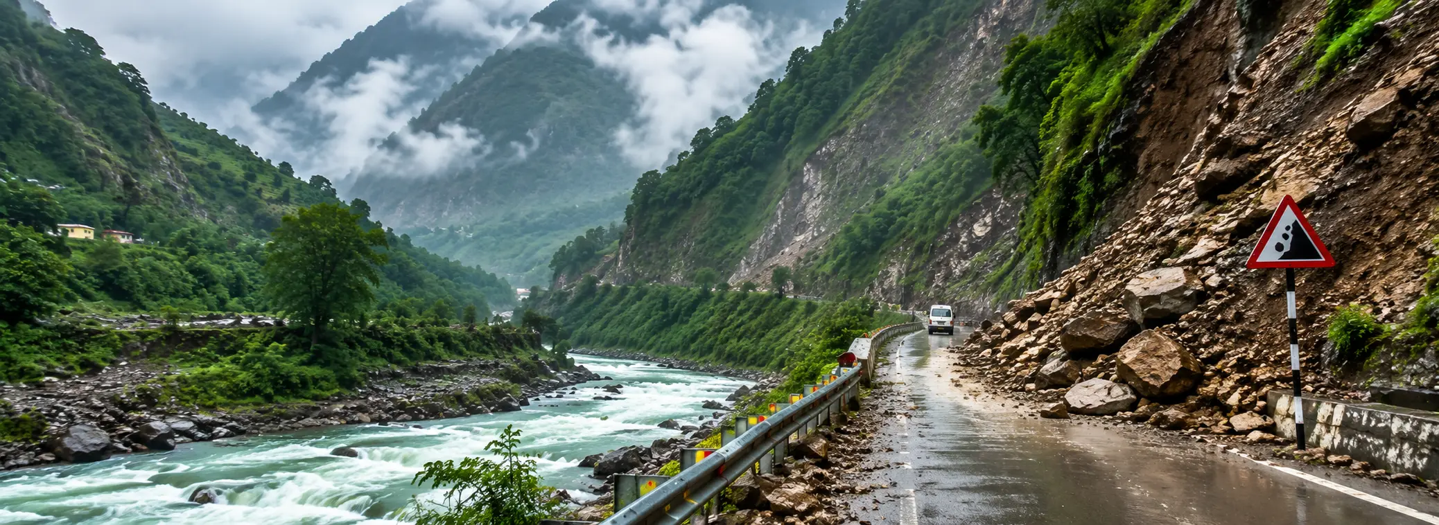
Landslides on the Char Dham route aren't rare, freak events. They're a predictable part of travelling through the Himalayas during monsoon, and once you understand where they tend to happen and how the warning system works, they stop being this vague, scary thing and become something you can actually plan around. This isn't a general "be careful" article. It's the specific stretches to watch, what the alert colours actually mean, and what to do in the moment if you find yourself near one.
Understanding the Alert Colours
The India Meteorological Department issues colour-coded alerts for Uttarakhand through the monsoon, and most pilgrims see these mentioned in news reports without really knowing what to do with the information. Here's what each one actually means for someone on the road.
| Alert | What It Means | What You Should Do |
|---|---|---|
| Yellow | Be aware — moderate rain expected | Continue as planned, but check for updates through the day |
| Orange | Be prepared — heavy rain likely | Delay non-essential travel; avoid known vulnerable stretches |
| Red | Take action — extremely heavy rain, high landslide risk | Halt at your current base point; do not attempt onward travel |
I tell every group I send out the same thing: an orange alert isn't a suggestion, it's the administration telling you they expect trouble. On an orange or red alert day, staying put at Guptkashi or Barkot for one extra day is a far better outcome than getting stuck on a blocked road with nowhere to turn around.
The Stretches That See the Most Trouble
Every route has a handful of spots that come up again and again in landslide reports. Knowing these in advance changes how you drive through them — most drivers who know the route will simply slow down, avoid stopping, and stay alert through these sections rather than treating the whole highway as equally risky.
Landslide-Prone Stretches by Route
- Gangotri highway: around Netala and Gyansu, near Uttarkashi town
- Yamunotri highway: near Barkot, and the stretch close to Janki Chatti
- Badrinath highway: around Chhinka and Lambagad in Chamoli district
- Kedarnath route: the Munkatiya area and near Agastyamuni in Rudraprayag district
None of this means these exact spots will always be the trouble spots this season — hillsides shift, and a stretch that's stable this year can become active the next after enough rain. But historically, these are the names that keep coming up, and it's worth mentally flagging them as you pass through.
What to Actually Do If You're Caught Near One
This is the part most articles skip, so let me be direct about it.
- Stop at a safe distance, not right at the edge of the debris. Give yourself room to reverse if needed.
- Move away from the hillside, not toward it. If you're on foot, get to open ground rather than sheltering under an overhang.
- Don't try to drive through or around loose debris, even if it looks passable. Rocks and mud can still be shifting even after the initial fall.
- Don't linger directly under an unstable slope, even briefly for photos. Slopes that have already slipped once are often not done moving.
- Wait for the clearance team. JCBs and local disaster response staff are usually dispatched quickly, and routes are rarely closed for more than a day or two.
- Stay in contact with your driver or agency rather than relying on scattered social media posts, which are often outdated or exaggerated by the time they reach you.
⚠ Never Do This
Don't attempt a shortcut or "local" alternate track you've heard about from a stranger on the road. Unofficial detours around a closure are almost always riskier than the closure itself.
Preparing Before You Even Leave
A few small things done before you set out make a real difference if you do run into a landslide-related delay:
- Carry extra water and some dry snacks in the vehicle — enough for an unplanned few hours' wait
- Keep phone numbers for your travel agency and driver saved offline, not just in a messaging app that needs signal
- Note down the local SDRF or district disaster helpline number for whichever district you're passing through that day
- Fill your fuel tank at every opportunity rather than waiting until it's low, since fuel stations can be hours apart in the hills
I've been driving these roads since before some of my drivers were born, and if there's one thing I've learned, it's that the landslide itself is rarely the dangerous part — it's people panicking afterward, trying to push through or find a shortcut, that causes the real trouble. Stay calm, stay put, and let the clearance teams do their job.
Frequently Asked Questions
What do the yellow, orange and red alerts mean?
Yellow means stay aware, orange means be prepared for heavy rain, and red means take action — halt travel and wait it out at your base point.
Which stretches see the most landslides?
Netala and Gyansu on the Gangotri highway, Barkot and Janki Chatti on the Yamunotri highway, Chhinka and Lambagad on the Badrinath highway, and Munkatiya and Agastyamuni on the Kedarnath route.
What should I do if caught near a landslide?
Stop at a safe distance, move away from the slope, don't attempt to drive through debris, and wait for the official clearance team.