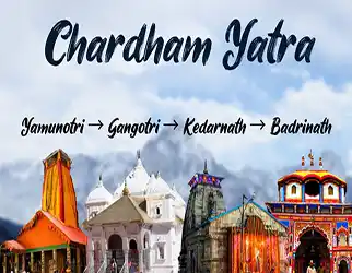
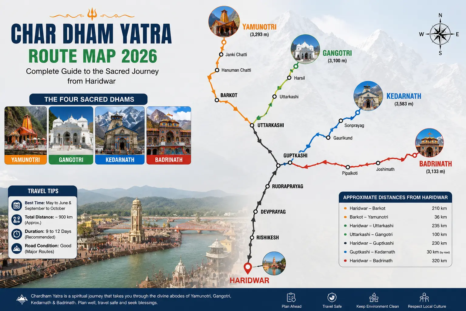
People ask me this almost every week during the season: "Rahul ji, kaunsa route best hai?" And honestly, there's only one route that makes real sense once you look at the map — Yamunotri, then Gangotri, then Kedarnath, then Badrinath. It's not a rule someone invented for tradition's sake. It's just how the roads are laid out. Try to do it any other order and you'll end up backtracking across the same stretches you already covered, which wastes a full day or more.
I've driven this circuit more times than I can count over the last 37 years, and the questions people have haven't really changed — how far is it, what shape are the roads in, and does the route order actually matter. So let me walk through it the way I'd explain it to someone sitting across from me at the office.
Why Yamunotri First, Badrinath Last
The circuit runs west to east. Yamunotri sits furthest west, closest to Haridwar in relative terms, and Badrinath sits furthest east. If you start at Yamunotri and finish at Badrinath, you're moving in one direction the whole time. Skip around — say, do Kedarnath first because it "sounds harder, get it out of the way" — and you'll be driving back through Rudraprayag and Devprayag a second time to reach Yamunotri or Gangotri later. That's extra hours on roads that are already slow-going in the mountains.
There's a practical side benefit to the traditional order too. Kedarnath, the toughest leg with its 16 km trek from Gaurikund, lands in the middle of your trip rather than at the start. By then you've had a few days to adjust to the altitude and the road conditions, which honestly makes a difference for anyone over 50 or travelling with elderly family.
Distance Between Each Stop
Everyone wants exact numbers, so here they are — these are approximate road distances, since exact figures shift slightly depending on which route variant you take through Chamba or Narendranagar.
| Stretch | Approx. Distance | Drive Time |
|---|---|---|
| Haridwar to Yamunotri (via Barkot) | ~230-250 km | 9-10 hours |
| Distance between Haridwar to Gangotri | ~300 km | 9-10 hours |
| Gangotri to Gaurikund | ~230-250 km | 9-11 hours |
| Gaurikund to Kedarnath (trek) | 16 km | 5-7 hours on foot |
| Kedarnath to Badrinath (via Rudraprayag) | ~220-230 km | 9-10 hours |
| Haridwar to Badri distance (direct, non-circuit) | ~320 km | 10-11 hours |
| Badrinath to Haridwar (return) | ~310-320 km | 10-11 hours |
Add it all up and the full circuit of Chardham Yatra from Haridwar, out and back, comes to somewhere between 1,200 and 1,600 km depending on the exact route variant you take — I usually tell first-time pilgrims to budget for the higher end so they're not caught off guard.
What the Roads Actually Look Like Right Now
This is the part that changes month to month, so treat everything below as a snapshot rather than gospel. As of August 2026, we're still inside the monsoon window, and that shows on the ground — the Yamunotri and Gangotri highways around Uttarkashi have seen repeated debris and rockfall from the rain, with sections near Dharasu closing for hours at a stretch before clearing crews get through. The Badrinath National Highway through Chamoli and Rudraprayag has had its own share of disruptions too.
None of this means the roads are impassable. It means they're unpredictable, which is a different problem. A road that's clear at 8 AM can have a rockfall by noon after an hour of heavy rain. That's why I keep telling people: travel in the morning, never after dark, and don't treat any road advisory as permanent — check it again the same day you're driving.
⚠ If You're Travelling in August
Build at least one extra buffer day into your itinerary. Start each day's drive early, avoid the Yamunotri-Gangotri stretch after heavy overnight rain, and don't push through a blocked section — wait for the clearance crew rather than trying an alternate track you're not familiar with.
If you can shift your travel window even a couple of weeks toward late September, do it. The rain eases off, the roads firm up, and honestly the mountains look their best right after the monsoon clears — that post-rain green is something photographs never quite capture.
So, Which Route Is Actually Best?
For most pilgrims coming from the plains, Haridwar is still the better starting point over Rishikesh — slightly more hotel options, better connectivity if you're arriving by train, and it's where most fixed departure vehicles are based anyway. From there, stick with the traditional order. I've seen agencies try to sell "custom routes" that skip around for convenience, and nine times out of ten it just adds driving hours without saving any real time.
One thing I will say — if road conditions on a particular stretch are genuinely bad on the day you're meant to travel, don't be rigid about the plan. A good driver who knows the route will sometimes suggest waiting half a day rather than pushing through a landslide-prone section. That flexibility matters more than sticking to a printed itinerary.
I've had pilgrims ask me to change their whole route because a WhatsApp forward said one road was "closed forever." Most of these closures clear within a day. Check the official advisory, not the forward.
Frequently Asked Questions
What is the distance between Haridwar and Gangotri?
Around 300 km by road, via Rishikesh, Chamba and Uttarkashi — usually 9-10 hours, and most pilgrims split this across two days with a halt at Uttarkashi.
How far is Badrinath from Haridwar by road?
Roughly 320 km via Rishikesh, Devprayag, Rudraprayag and Joshimath, taking about 10-11 hours with a night stop midway.
Which is the best route for Char Dham Yatra in 2026?
The traditional Yamunotri-Gangotri-Kedarnath-Badrinath order, since it follows the actual road network without unnecessary backtracking.